Description
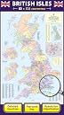
🗺️ Own the UK map that means business and wanderlust combined!
- NAVIGATE LIKE A PRO - Integrated 2026 UK road map with motorways and primary roads clearly marked.
- DURABILITY MEETS STYLE - Laminated, tear-resistant finish lets you write, wipe & highlight endlessly.
- UP TO THE MINUTE ACCURACY - Reflects latest administrative changes and population data for reliable insights.
- PINPOINT PRECISION BOUNDARIES - Accurate counties, districts & unitary authorities for expert-level planning.
- THE ULTIMATE TRAVELERS WALL ART - A chic, functional map that doubles as a conversation-starting decor piece.
This large, laminated UK wall map (830 x 1200 mm) features detailed county, district, and postcode boundaries alongside the latest 2026 road networks. Designed for professionals and travelers alike, it offers a wipe-clean surface for easy route marking and is updated with current population figures and administrative changes, making it a stylish yet practical addition to any home or office.