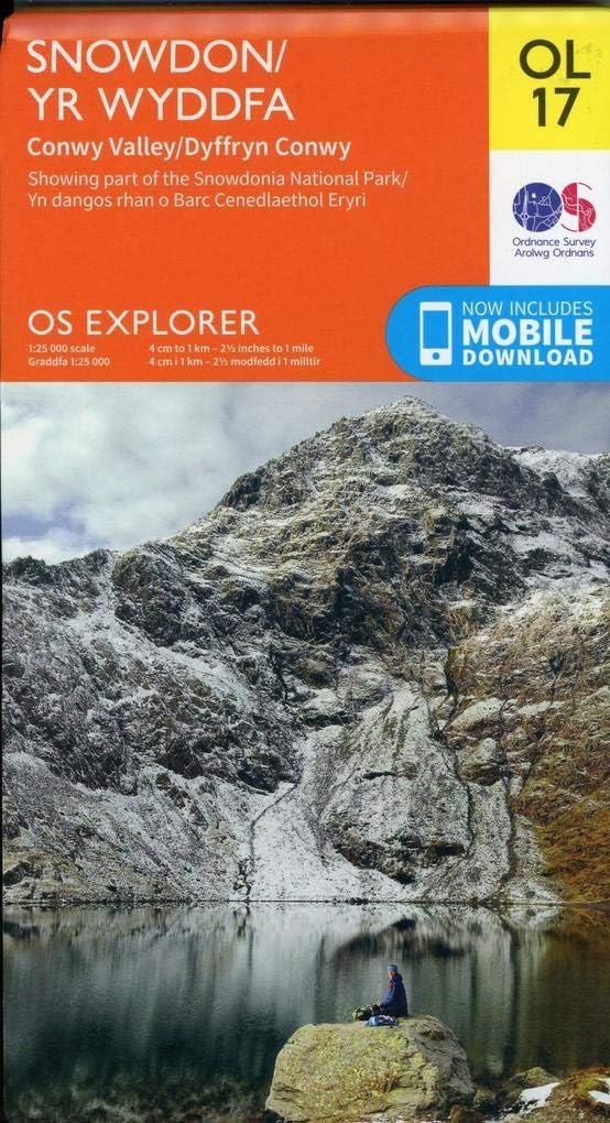
Snowdon / Yr Wyddfa Map | Conwy Valley / Dyffryn Conwy | Ordnance Survey | OS Explorer Map OL 17 | Wales | Walks | Hiking | Maps | Adventure
Product ID: 117640260
Desertcart purchases this item on your behalf and handles shipping, customs, and support to Croatia.
Discover the unforgettable sights of Northern Snowdonia, from the wild, rugged grandeur of Snowdon itself to the quaint seaside towns and spectacular castles of Colwyn Bay and the Menai Strait. Follow the Wales Coast Path, explore the stunning historic island of Anglesey and immerse yourself in the jagged peaks of Snowdonia. Climb the largest mountain in Wales and do it your way, with a choice of six routes to the summit of Mount Snowdon Travel back in time by visiting the spectacular Beaumaris, Penryhn and Caernafon castles or the seaside towns of Colwyn Bay and Llandudno Walk some of Britain’s most beautiful countryside along the Wales Coast Path and North Wales Path OS Explorer Maps: 1:25 000 scale (4 cm to 1 km – 2½ inches to 1 mile). Great for walkers, hikers, cyclists, families, dog walkers, and horse riders. Includes roads, rights of way, permissive paths and bridleways, plus essential visitor information. Free digital download included. Other Ordnance Survey Snowdonia maps include Harlech, Porthmadog & Y Bala Explorer map OL18, Llyn Peninsula East Explorer map 254 and Vale of Clwyd Explorer map 264 Review: Os maps - Good os map Review: My home is on this great map - Beautiful north Wales. My home in the Conwy Valley is on this map. We're so lucky to have such good mapping in the UK.



| Best Sellers Rank | 4,646 in Books ( See Top 100 in Books ) 6 in Walking (Books) 6 in Hiking (Books) 7 in Hiking & Walking Holidays |
| Customer Reviews | 4.8 out of 5 stars 1,418 Reviews |
A**R
Os maps
Good os map
P**N
My home is on this great map
Beautiful north Wales. My home in the Conwy Valley is on this map. We're so lucky to have such good mapping in the UK.
C**S
Trustworthy
Good map
C**L
Useful Map
Great for planning trip to snowdonia, looking forward to using it in the summer. OS maps are the best for those finer details, footpaths, bridle path etc
T**T
Very practical
This series of maps is very practical for any user of the countryside
S**K
Quality map
Very detailed map
F**K
Don't climb mountains without one
Weatherproof OS map, what's not to love? The detail is unrivalled and makes route planning a doddle. Stick it on the outside of your bag for easy access and zero worries of rain. They do unfold to a large size which can make them quite cumbersome when out walking, but you can always fold them into whatever shape you need or work out which section you need on any given day and the easiest way to access that page with minimal unfolding. I never venture into the great outdoors without one of these a compass and neither should you.
D**D
Don't head out without a map!
Knowing where you are is important in getting yourself to where you are heading and back again. OS Explorer maps provide a detailed topographic view of Snowdon / Yr Wyddfa and the main routes up the mountain. Combined with the OS Maps app which for which a digital download is included, you can view, plan and watch your progress.
V**E
schneller geliefert als gedacht !! super
zum einen schneller geliefert als gedacht !! super und die qualität der OS mappen kenne ich schon, sind ungeschlagen gut.
H**E
The heart of Snowdonia...
This Ordnance Survey Explorer map captures the heart of the Snowdonia National Park in northwest Wales. Coverage includes Snowdon itself, the valleys entering the park from the area of the Menai Strait, and the area west of the Conwy River. The map is a very user friendly 1:25,000 scale, with easy to read color graphics and a download for your mobile phone. Although the cover is plasticized, the map itself is paper and will need protection from the weather. The Snowdonia National Park contain tremendous landscapes and opportunities for hiking and climbing, but there is also potential danger due to rough ground and variable weather conditions. Highly recommended to the enterprising traveler.
Trustpilot
2 days ago
2 weeks ago