


🌍 Elevate Your Surveying Game with Precision!
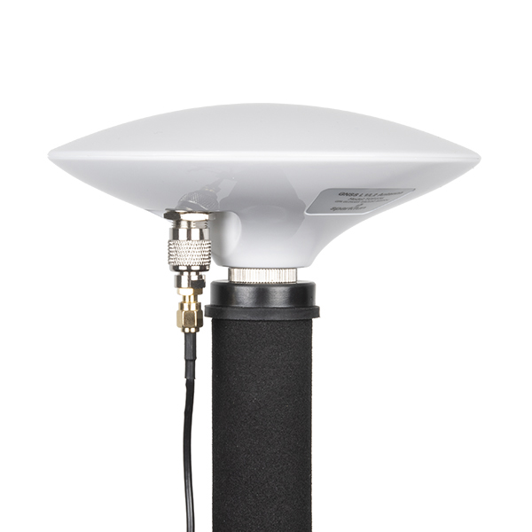
The SparkFun RTK Express Kit is a high-precision geolocation and surveying solution designed for both novice and expert users. It includes a GNSS receiver, multi-band antenna, and a portable carrying case, allowing for quick setup and centimeter-grade measurements. Ideal for outdoor use, this kit is perfect for professionals seeking accuracy and reliability in their surveying tasks.
D**V
This thing was a lifesaver
This thing is awesome!! Truly saved my trip. I purchased some land in Belize (which does not have RTK service) so I had options of renting an expensive EKS Arrow Gold device (not cheap, sub-foot precision via Atlas satellite) or buying unproven Columbus P-10 device. At the last minute literally before my trip I found this device. And oh boy I’m glad I did. My drone broke and I could not rely on photogrammetry to do surveys. But this device and Android based SW Maps (bad usability app but ok) allowed me to complete the job.The horizontal precision without RTK was 14cm-24cm (1-2ft) and getting better with averaging, also worked surprisingly well under jungle canopy. Vertical precision was worse but luckily I did not need it.
P**.
I need help with this machine...
They sent me a defective product. The accelerometer wasn't working, and they knew it had this problem (see the sparkfun forums). Now support isn't answering my questions. Not sure where to turn! Please do research before buying...Later: I was able to send it back and get my money back... Thanks for that! I would still like to have another one that does work!
A**J
They said 10 mm more like 10 inches
There was considerable time that I spent before I made my decision to purchase this. I read and studied and researched and read some more and watched every video available. I was prepared and ready to make a purchase. So I did and it came. I studied so much I could have taught a class, but that didn’t help me achieve the 10 or even 14 mm they claim, the best I could get was 4-11 inches. And no you just don’t plug it in and you’re set. You need to download some apps or pay for a subscription or get in touch with local GIS to get NTRIP login info and 99% ain’t free. So for approx $1000 you got a Garmin. Easiest thing to do is the buy another and set that up. That’s my next move but I won’t be buying Sparkfun again.
Trustpilot
1 week ago
1 week ago